
Walking a McAllen Street by Address
A McAllen street directory search starts at the address rather than a name. First locate the property in HCAD and record the owner of record, situs, mailing address, account or geo identifier, legal description, and subdivision. Then view the parcel in the City GIS map. The map makes the street and adjacent parcels visible, while the appraisal card provides the record fields. Neither source alone proves who is currently inside a house.
Continue with the County Clerk deed index. A recorded document connects grantor and grantee names to a date and legal description. For a past address, a Cole’s Cross volume can add a listed occupant for that volume’s date. Voter status remains an individual official lookup or a controlled request process, not a street browser. That order keeps the McAllen street directory focused on address-keyed evidence rather than a guessed roster.
- Search HCAD with the street number and street name, then save the account, geo ID, situs, and legal description.
- Open McAllen GIS Tax Parcel Viewer and click or pan along the same street to identify parcels that need separate checks.
- Use the Hidalgo Tax Office address mode or its optional second field to narrow a street and owner intersection.
- Search the County Clerk index for the owner as grantee, using subdivision or lot and block wording when needed.
- For an earlier interval, compare the deed date with Cole’s Cross, telephone-book, or city-directory volumes held locally.
McAllen Street Directory Search Fields
HCAD offers a compact set of address tools, but the query format matters. Its help says an owner search works with “Lastname, Firstname” or “Lastname Firstname.” For an address, use the street number and name and leave off a prefix or suffix such as NE or Ave. An account number must be exact. This small adjustment can recover a parcel that a fully formatted street query misses.
| HCAD field | Format | Street-directory value |
|---|---|---|
| Owner name | Last name first, with or without comma | Finds taxable owners, not every occupant |
| Property address | Street number plus street name | Finds a parcel when a McAllen address is known |
| Account number | Exact appraisal-district number | Anchors later correction or tax research |
| Legal description | Read from the result card | Bridges a street label to deeds and plats |
The Hidalgo County Appraisal District search is the official entry point for those McAllen street directory queries.
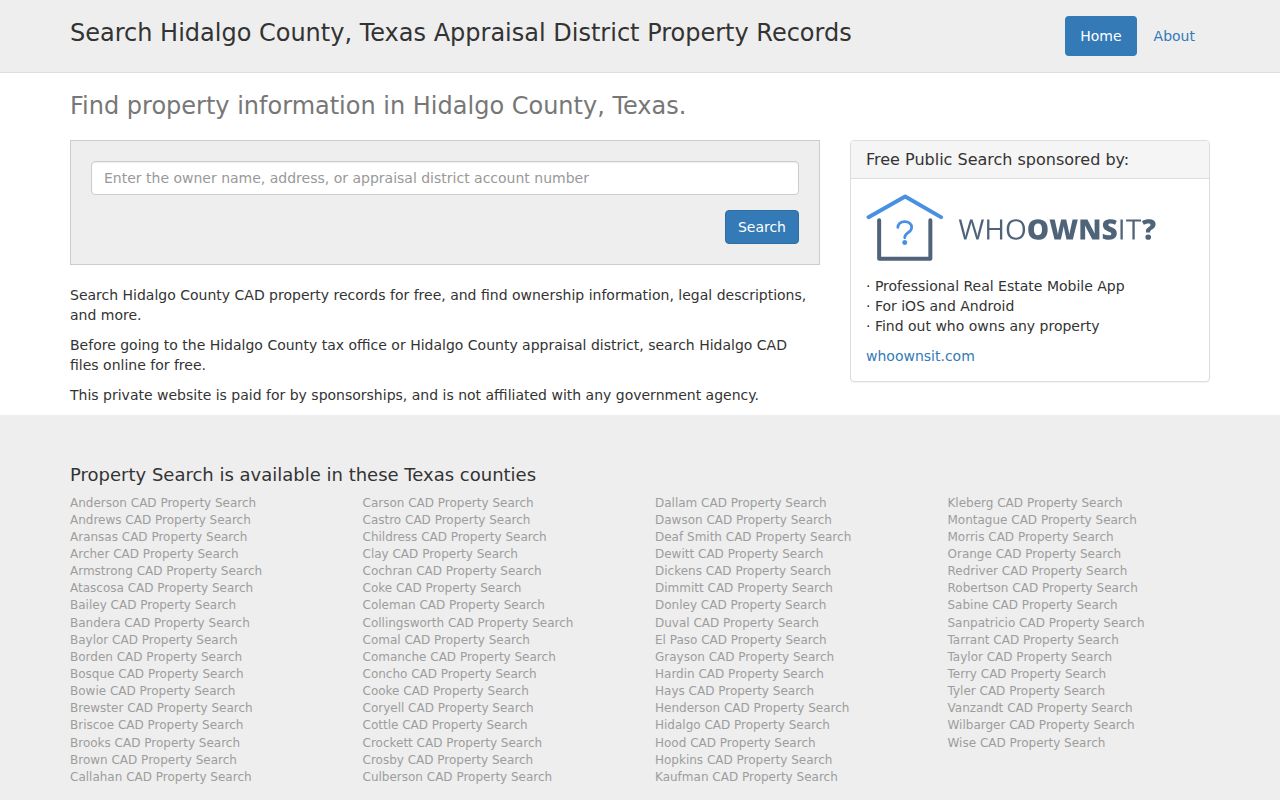
A simplified street search produces a parcel lead that should be checked against the card’s situs and legal-description fields.
McAllen Streets in the Tax Search
The Hidalgo Tax Office form provides the closest reviewed route to a targeted street-and-surname check. Step 1 accepts an account number, owner name with last name first, property address that starts with the entered text, CAD reference number, or fiduciary number. Step 2 is optional and can narrow the first result set by owner, address, account, or CAD reference. The office’s example combines an owner surname with a street fragment.
Use the result as a way to locate taxable accounts, not as proof of a person’s physical presence. The mailing address may belong to a representative, a business, or a prior location. Once an account is found, the public tax and HCAD entries can be compared, and a certified statement can be requested by email through the tax-office process after account discovery.
The Hidalgo County Tax Office search shows the two-step owner, address, account, CAD-reference, and fiduciary options.
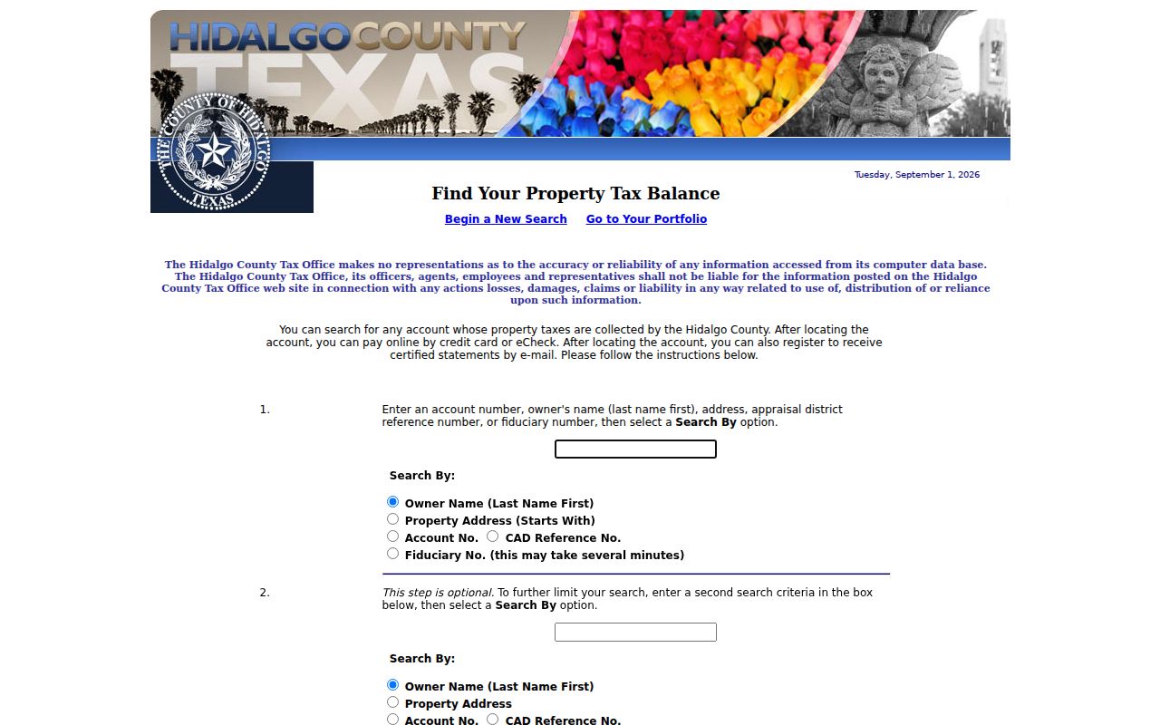
The optional second criterion is especially useful when a common McAllen surname and a street fragment need to be separated from similar accounts.
McAllen Street Maps and Parcels
City GIS supplies the visual part of a McAllen street directory trail. The hub links Tax Parcel Viewer, corporate limits, zoning and development, FEMA flood zones, school, HOA, census, poll-place, growth, drainage, and transportation layers. Start with the parcel viewer, locate the street, click the target polygon, and note any parcel or owner reference the live layer exposes. Pan one parcel at a time to inspect a block without claiming the map certifies title.
McAllen began developing GIS technology in 2002. The resulting layers explain record geography, such as why a street’s city limits, school layer, HOA map, postal city, and county precinct may not match. The static hub does not list a public radius or export control, so a whole-street set still requires parcel-by-parcel checking in the tax and appraisal records.
The City of McAllen GIS hub provides the Tax Parcel Viewer and boundary layers used in this street research.
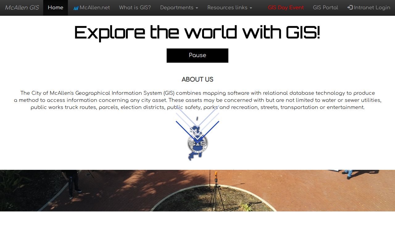
Map context helps separate a McAllen street label from the official parcel, city-limit, and subdivision terms needed for the next record.
McAllen Records Searchable by Street
Address evidence is strongest when each source is assigned a narrow job. The parcel card identifies the taxable record. The tax account adds billing and payment context. GIS maps the parcel. The Clerk records conveyance and plat documents. Accela may show a dated application or inspection. Historical reverse directories add a listed address connection for a particular year. The street name is only the entry point, not the full record key.
| McAllen street record | Custodian | Address connection | Access |
|---|---|---|---|
| Appraisal parcel card | Hidalgo CAD | Owner, situs, mailing address, legal description, exemptions | Free owner, address, or account search |
| Tax account | Hidalgo County Tax Office | Owner, property address, account, CAD reference | Free search with optional second criterion |
| Parcel and city layers | McAllen GIS | Parcel geometry, limits, zoning, map context | Public map |
| Recorded deeds and plats | Hidalgo County Clerk | Grantor, grantee, date, lot, block, subdivision | Public index; copies through clerk process |
| Permit and planning records | McAllen Accela | Address, permit type, date, applicant, inspection status | Public modules; some features may need account access |
| Cole’s Cross volumes | McAllen Library / UTRGV | Historical address-to-listed-occupant connection | In-house or archive consultation |
For a street-wide modern parcel chain, keep the account or legal description with each result. For the historical shelf and volume-by-volume directory research, use the McAllen city directories rather than stretching a current tax record into a past household claim.
McAllen Street Deed Chains
Deeds are organized around parties and legal descriptions, not just today’s street label. After finding the HCAD card, search the current owner as a grantee in the County Clerk portal. Filter by date and likely document type, then preserve the grantor, grantee, recording date, document number, legal description, and image availability. Search the prior grantor as a grantee before the later deed to move backward. When a description changes, search the subdivision, lot, block, abstract, or survey wording as well.
The portal’s quick search has one search-term box, recorded-date fields, presets, and a choice between index-only and full-text OCR. Index-only is suited to the party or subdivision entry. OCR can identify a phrase in document text, but should be checked against the document image. The online portal was certified through August 24, 2026 during research, but its oldest online year was not stated. For a missing earlier deed, contact the Clerk about books, microfilm, or archived images in Edinburg.
For one McAllen block, keep a simple record trail for each parcel: current account or geo ID, current owner, legal description, document number, recorded date, and the prior party. That sequence makes it possible to compare deeds without assuming every transfer describes the same tract. A recorded instrument can affect only part of a larger parcel or an easement. When that happens, inspect the plat and the lot or block wording before attaching the transfer to a modern street number. The County Clerk’s office is at 100 N. Closner in Edinburg and lists weekday hours from 8 a.m. to 5 p.m.; call (956) 318-2100 to ask whether an older item is in a book, microfilm, or archive.
The Hidalgo County Official Records portal provides the term, date, search-scope, registration, and cart controls described here.
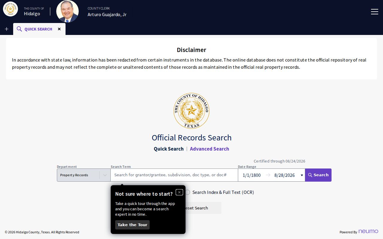
The document index can trace ownership intervals along a McAllen street, while the legal description guards against a misleading address-only match.
McAllen Street Permits and Directories
McAllen’s Accela portal adds dated property activity. Its Building Permit search exposes permit type, permit number, start and end dates, street number, direction, street name, street type, unit type, and unit number. The related property-information lookup offers Address, Parcel Information, and Owner modes plus acreage, area, development, district, electric utility, and elevation fields. Those fields can distinguish similar street numbers or developments, but an applicant may be a contractor or representative rather than a resident.
For an older street layer, the City historic-preservation guide identifies Cole’s Cross Directory from 1960 to date, Lower Rio Grande Valley telephone books from 1923 forward, and local city-directory runs. A criss-cross directory is the address-order section of a volume. It can show the listed name at a street number for that year, then deeds and tax data can test whether the listed person was an owner, a renter, or a business contact. The historical directory page covers those collections in detail.
- Parcel
- A separately identified taxable property unit.
- Situs address
- The property location on the tax roll, not the correspondence address.
- Plat
- A recorded map showing lots, blocks, streets, and easements in a subdivision.
- Criss-cross directory
- An address-first directory section that points to a listed name for the volume date.
McAllen Street Addresses and ZIPs
A postal label does not draw the McAllen city boundary. Five standard ZIP codes use the McAllen city name: 78501, 78502, 78503, 78504, and 78505. USPS is the address-level authority, while City GIS corporate limits gives local municipal context. A ZIP result standardizes a delivery address but does not confirm a person or company at that address. Nor does a postal-city label prove the parcel sits within city limits.
For a historic McAllen street that no longer matches a modern query, search street-name variants and the legal description, then use old directory street indexes, Sanborn maps, plats, and the library. Research did not locate an official citywide street-renumbering or renaming year. That gap matters: do not supply a guessed conversion date. Ask Planning, GIS, the County Clerk, or the library for the document that bridges the older name to the parcel.
Note: A ZIP, city limit, county precinct, school layer, and subdivision label can all describe the same McAllen street differently.
McAllen Street Directory Boundaries
A McAllen street directory cannot reveal every household member. HCAD generally indexes ownership and account information, not renters. The individual voter tool is not a street-by-street resident list. DMV personal addresses are restricted under the Driver’s Privacy Protection Act, and utility-customer or postal-delivery information is not an ordinary public directory. Protected voters and qualifying officials can have residence details withheld or replaced.
Use a property record to describe a property relationship, a deed to describe a recorded transfer, and a historical directory to describe a dated listing. Those limits are as important as the search steps. An empty result may reflect protected information, a different custodian, or an unindexed historical volume.
Lawful use. McAllen address records are suitable for personal, civic, family-history, and consumer-safety research. Do not use them to stalk, harass, intimidate, or harm anyone.